Inaccurate well records cause headaches for property owners
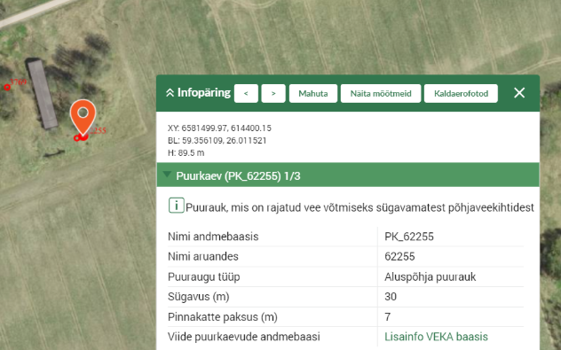
The Environment Agency fields hundreds of requests a year to correct the locations of drilled wells on state maps, as registry data often has them in the wrong place.
One family found this out when the Environmental Board rejected its notice for installing a septic tank, saying the planned tank would sit on top of a mapped well. A drilled well does exist on the property, built and fully documented according to regulations in the 1990s, just not at the exact location listed.
Timo Torp, a leading specialist at the Environment Agency's Environmental Use Department, said they receive hundreds of requests a year to correct well data, because locations entered on maps decades ago are sometimes inaccurate.
"We see about 500 cases come in each year," Torp said.
Such discrepancies are often discovered during planning or construction work, when a mapped well triggers restrictions on what can be built nearby. People then contact the agency to have the data corrected, he added.
The Environment Agency is responsible for maintaining the registry, but not for the well-location data itself, which falls under the Environmental Board's remit.
While the board doesn't keep precise track of the number of cases it refers to the agency each year, Water Department director Triin Mägi acknowledged it's dozens each year.
"You have to understand, we have tens of thousands of wells and boreholes listed in registries," Mägi said. "The amount of data that continuously needs to be reviewed and updated is pretty vast."
Torp said their registry data includes records for around 60,000 boreholes, including 40,000 roughly domestic wells.
Old records behind some inaccuracies
The Estonian Geological Survey (EGT) transferred its drilled well and borehole data to the Environment Agency in 2010. Torp said the dataset is largely historical, with the oldest records dating to the 19th century, when location measurements were far less precise than they are today.
"The problem isn't so much the data submitted to us today; it's the historical legacy that reached us when this data was handed over," he explained, adding that some of the records also originated on Soviet-era paper maps.
In some cases, discrepancies amount to just a few meters. In others, a well shown on the map turns out not to exist at all.
"GPS has been widely used since the second half of the last century," Torp noted. "The accuracy of anything older than that is questionable."
Mägi said improving data accuracy is an ongoing process.
"It's nothing extraordinary," she said. "There are people behind this. Sometimes those restrictions simply need to be displayed differently."
--
Editor: Mari Peegel, Aili Vahtla